High water levels and floods in Poland
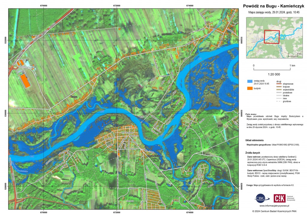
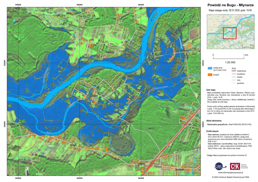
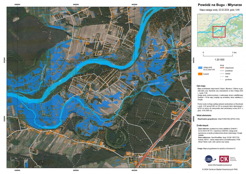
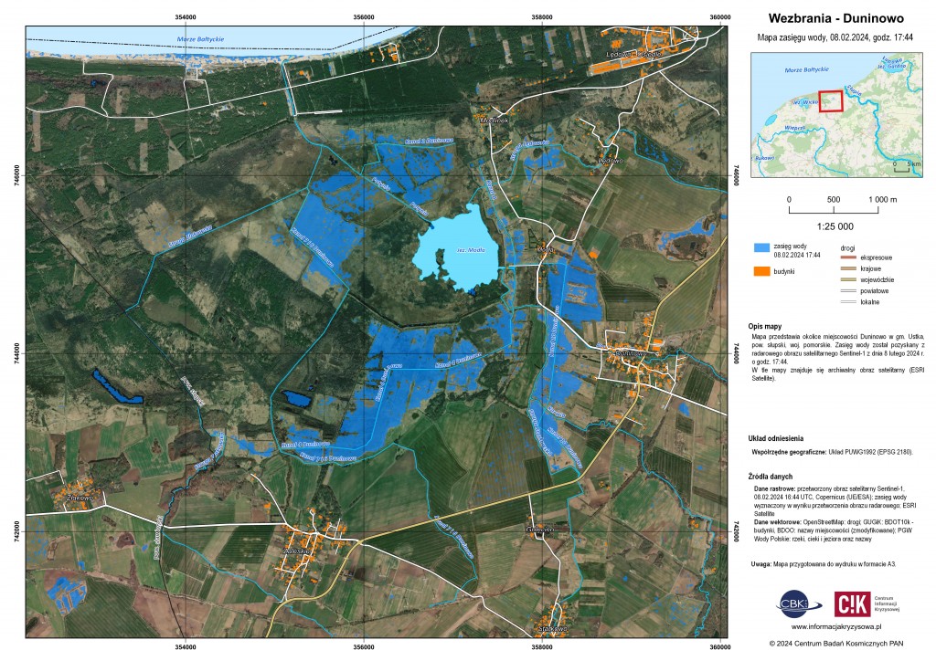
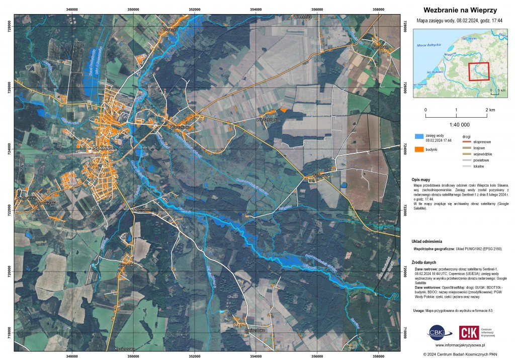
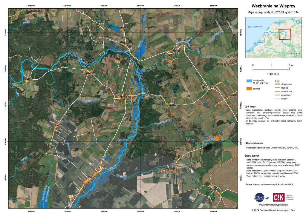
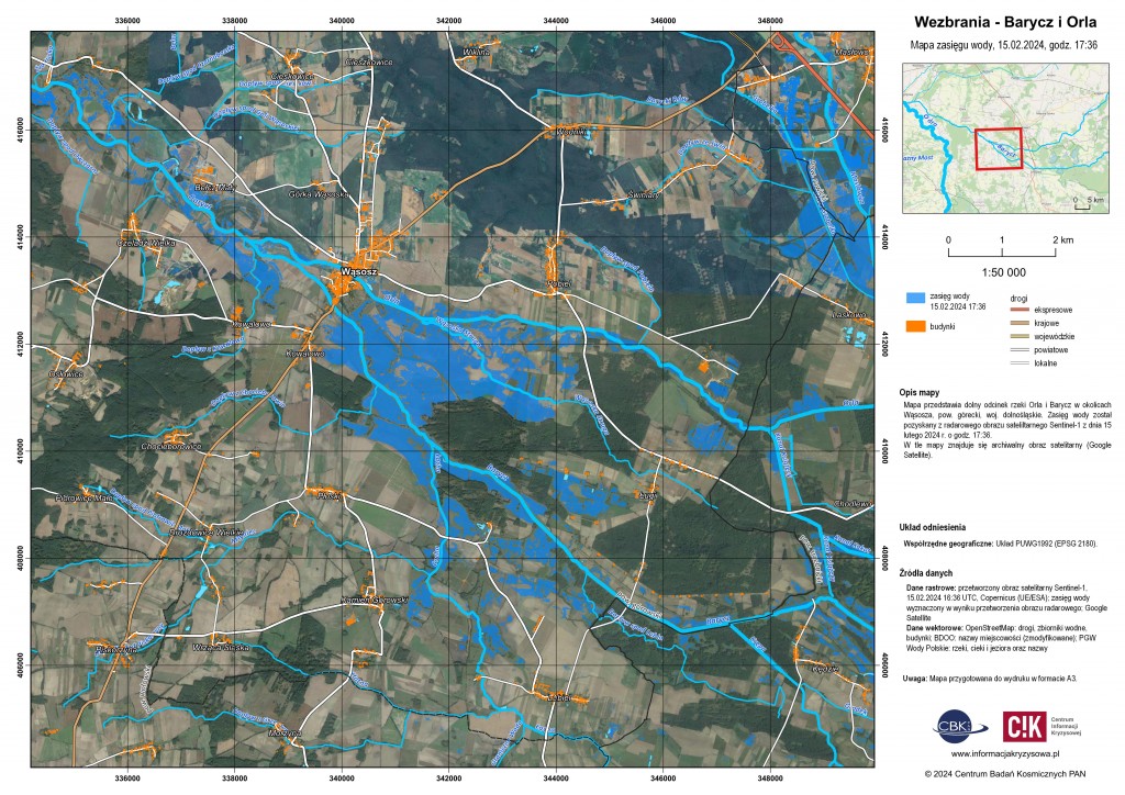
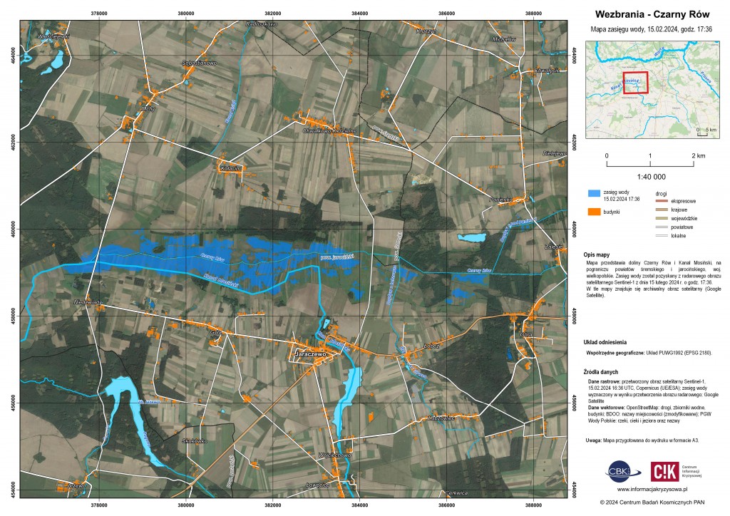
The snowmelt and rains observed in recent days have contributed to rising water levels and local flooding in many places in Poland. On the basis of up-to-date Sentinel-1 radar and Sentinel-2 optical imagery provided by the Copernicus programme, the Crisis Information Centre CBK PAN has developed water extent maps for areas located in the Mazowieckie, Pomorskie and Wielkopolskie Provinces.
Mazowieckie Province:
- 29.01.2024, 10:45 – sections of the Bug River above and below Wyszków,
- 02.02.2024, 5:44 – section of the Bug River near Młynarze, Wyszków Poviat.
Pomeranian Province:
- 08.02.2024, 17:44 – the surroundings of Lake Modła and Duninowo village in Ustka commune,
- 08.02.2024, 17:44 – the Grabowa River near Darłowo and the middle and lower section of the Wieprza River in the Sławno Poviat.
Wielkopolskie Province:
- 15.02.2024, 17:36 – rivers Barycz and Orla with their tributaries near Wąsosz, Góra Poviat,
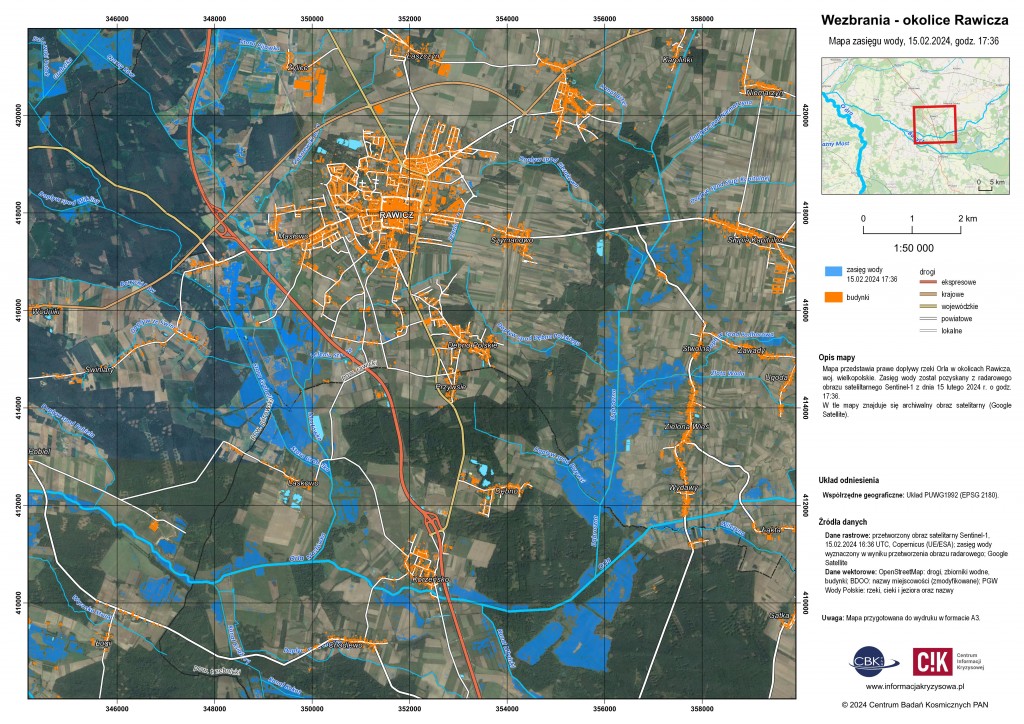
- 15.02.2024, 17:36 – Orla and its right tributaries near Rawicz,
- 15.02.2024, 17:36 – Mosiński Kanał and Czarny Rów on the border of Śrem and Jarocin Poviats, near Jaraczewo,
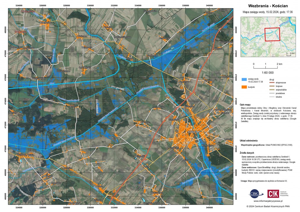
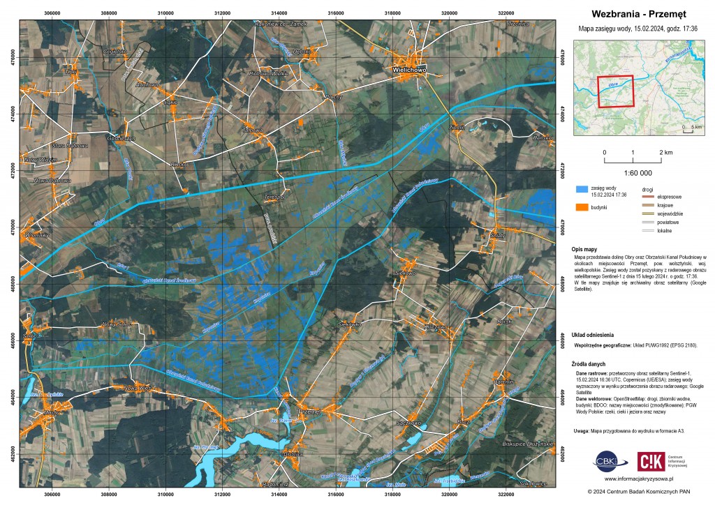
- 15.02.2024, 17:36 – Obra, Mosiński Kanał and Obrzański Kanał Południowy near Kościan and Przemęt (Wolsztyn Poviat).
The maps have been forwarded to the Departments of Safety and Crisis Management in Mazowieckie and Wielkopolskie Provincial Offices.


