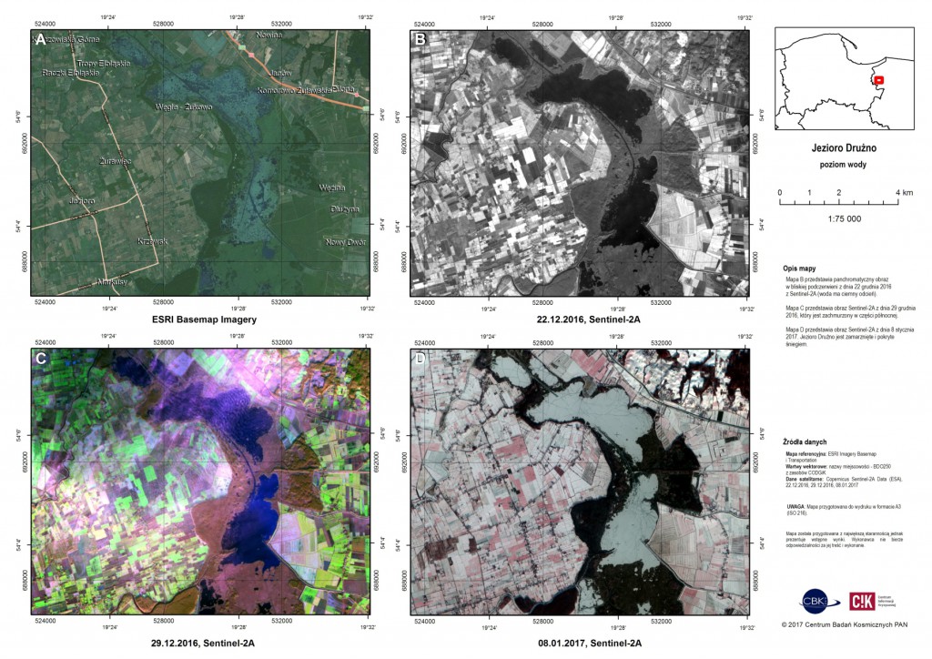
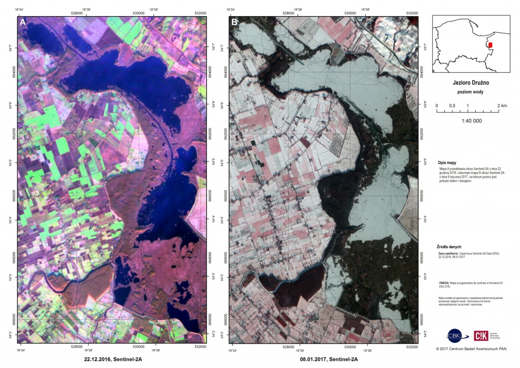
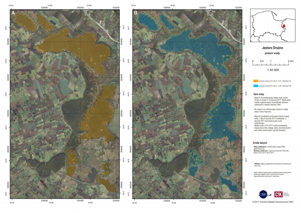
Situation maps of Drużno Lake area
At the beginning of January 2017 a strong wind from the north led to the so-called retreat in the Gulf of Gdansk and the Vistula Lagoon, which contributed to raising of the water level in the rivers and lakes in the delta of Vistula River.
On the request of the Department of Security and Crisis Management of the Warmińsko-Mazurskie Voivodship Office in Olsztyn, CIK prepared a situational map showing the Drużno Lake area at the turn of December 2016 and January 2017. Satellite data from the Sentinel-1A / B and Sentinel-2A satellites were used.