Log in
Register
Crisis information sources
CIK Activities
Operational products
Publications
New technologies
Menu
News
Operational products
Activities
Projects
Current projects
Finished projects
New technologies
Publications
About Us
News
Filtruj po:
Data od
Data do
Sortuj
Rosnąco
Malejąco
Tagi
16
April 2021
Geoinformation Guide: DEM and DSM
New Geoinformation Guide (only in Polish) concerns digital elevation and surface models which are openly accessible for Poland.
21
July 2020
Geoinformation Guide: Copernicus Open Access Hub - update
In today's entry from the "Geoinformation Guide" series, we present the Copernicus Open Access Hub browser designed to download free and open satellite images from the Sentinel mission.
17
July 2020
Geoinformation Guide: Earth Explorer
In today's article from the "Geoinformation Guide" series we will show you how to download free satellite images, eg from the Landsat mission, in a simple and quick way using the Earth Explorer browser.
09
May 2018
Geoinformation Guide: Viewing satellite images of Sentinel-2 and Landsat 8 - update
Today's publication of the “Geoinformation Guide” will introduce us to the secrets of satellite imagery. We will learn how to open satellite images and create color compositions. We will also learn what information is hidden in the filenames of satellite imagery.
04
December 2017
Geoinformation Guide: Sentinel Playground - update
In today's article from the series "Geoinformation Guide" you will get to know the functionality of the web application Sentinel Playground, which enables to visualize imagery coming from the Sentinel-2 satellite.
07
March 2017
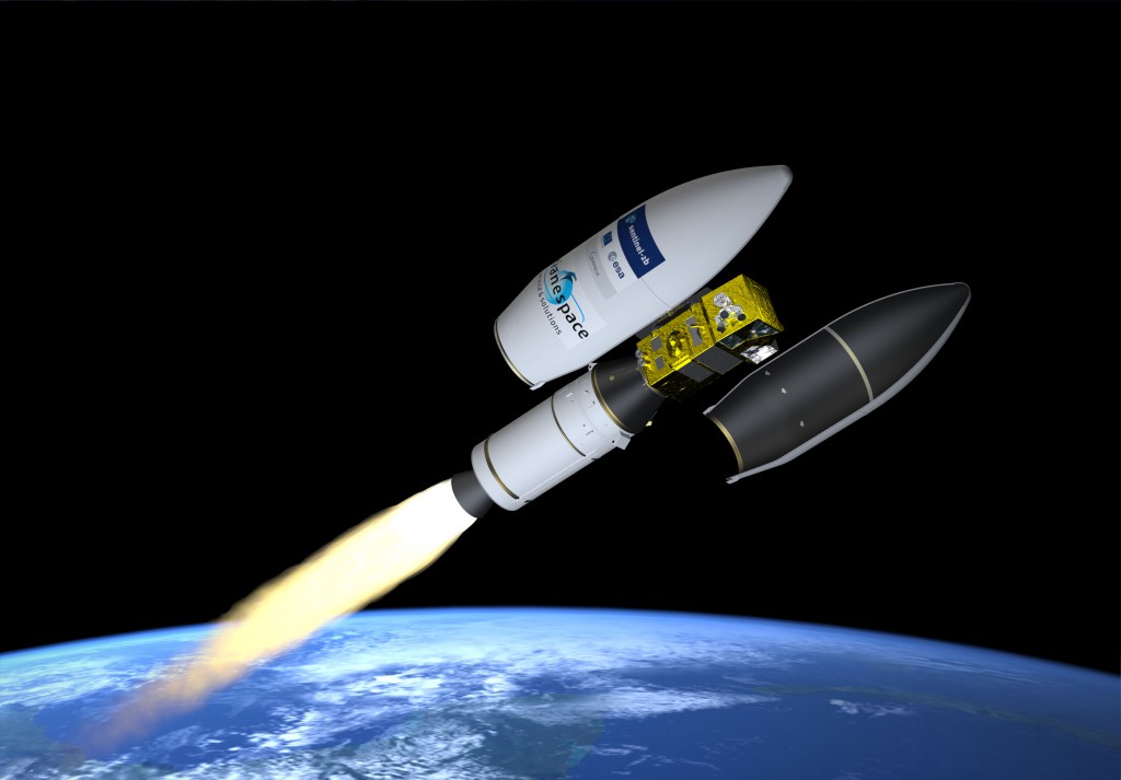
Sentinel-2B already in the orbit
Today’s night (2:49 CET) Sentinel-2B satellite, which is the twin brother of Sentinel-2A satellite, was launched from the spaceport in French Guiana.
06
March 2017
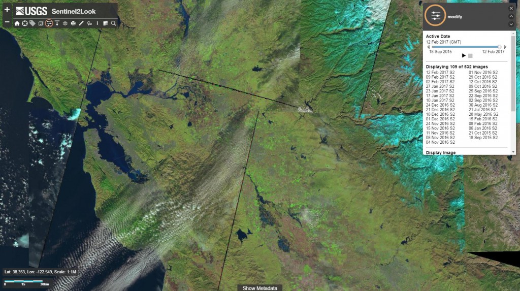
New Sentinel-2 image viewer application
US Geological Survey (USGS) has developed a prototype web application for Sentinel-2 imagery browsing and downloading - Sentinel2Look Viewer.
03
March 2017
The first edition of "Drones in geoinformation, crisis management, civil protection and infrastructure" training starting in March
Józef Tuliszkowski Science and Research Centre for Fire Protection – National Research Institute, as the organizational unit of the State Fire Service supervised by the Ministry of Interior and Administration, set up the Centre of Unmanned Systems "Drones Center". The Centre organizes a four-week training "Drones in geoinformation, crisis management, civil protection and infrastructure".
09
February 2017
Sentinel-2 and Landsat 8 data now available on the Planet Platform
Planet company, the world leader in imaging the Earth with the large constellation of nanosatellites, announced the integration of Sentinel-2 and Landsat 8 data on its Planet Platform. The difficult process of data integration turned out to be a success.
03
February 2017
DigitalGlobe supports crisis management
DigitalGlobe, the leading American provider of high-resolution satellite imagery, announced on its blog the launch of the Open Data Program, which aims to provide satellite data for selected large-scale natural disasters.
16
January 2017
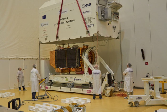
Sentinel-2B getting closer to space
Launching of the Sentinel-2B optical satellite is planned for 7th March. New satellite will join its twin Sentinel-2A satellite which is already in the orbit since June 2015. All of the operational tests that were conducted from 2016, ended up successfully, thanks to which Sentinel-2B has been transported to the spaceport in French Guiana.
08
January 2017
Geoinformation Guide: OpenStreetMap
Today's "Geoinformation Guide" series concerns the global OpenStreetMap project, which allows us to view and retrieve free vector data.
20
December 2016
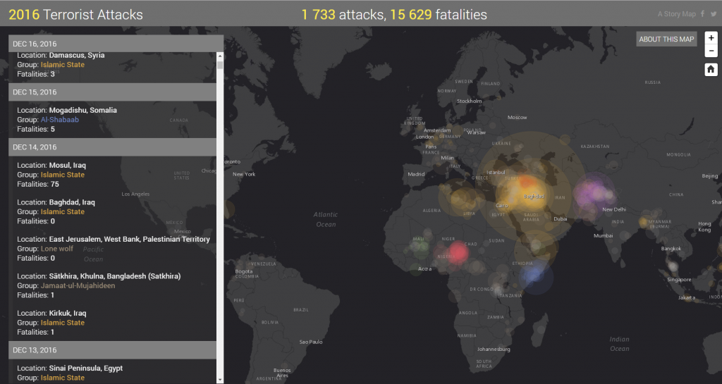
Terrorist attacks in 2016 on the map
Year 2016 abounded in terrorist events, which invariably shock the whole world. Information about the attacks in Brussels, Paris or about the latest attack in Berlin, in which many innocent people were killed, were circulated by the Western media. The Middle East remains the most inflammable spot in terms of terrorist attacks, in particular Iraq, Syria and Afghanistan. In addition, the alarming increase in terrorist attacks in Europe has been reported in 2016.
16
December 2016
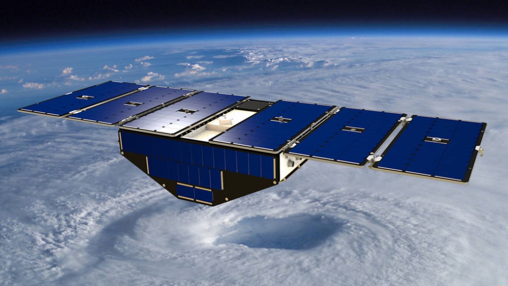
A new approach in hurricanes monitoring
On 15 December, NASA has launched a constellation of 8 microsatellites – Cyclone Global Navigation Satellite System (CYGNSS). The launch took place from the US Air Force Base at Cape Canaveral. Microsatellites were carried to low-Earth orbit 500 km above the Earth. CYGNSS is funded by NASA and its main developers are the University of Michigan and the Southwest Research Institute (SWRI).
15
November 2016
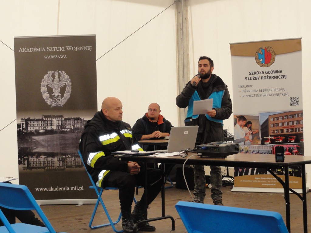
Demonstration of a comprehensive protection system for logistics of multi-entity rescue operations
On 9 November 2016, the final results of the project "A comprehensive protection system for logistics of multi-entity rescue operations", financed by the National Centre for Research and Development, were presented at the training ground of the Main School of Fire Service in Kazuń.
«
1
2
»
Ten serwis wykorzystuje pliki cookies.
Korzystanie z witryny oznacza zgodę na ich zapis lub odczyt wg ustawień przeglądarki.
Log in
The Address e-mail field is required.
The Address e-mail format is invalid.
The Password field is required.
The Password must be at least 7.
Forgot password?
Reset your password
The Address e-mail field is required.
The Address e-mail format is invalid.
Registration
The Name and last name field is required.
The Name and last name must be at least 7.
The Name and last name may not be greater than 50.
The Address e-mail field is required.
The Address e-mail format is invalid.
The Password field is required.
The Password must be at least 7.
Passwords dont match.